Compare pilots, licences and prices before anyone takes off. A free request for drone surveying and mapping in Randfontein goes to a drone surveyor covering Randfontein and nearby areas of Gauteng, and you see the offers side by side.
Drone Surveying and Mapping in Randfontein
Drone survey operators working around Randfontein map building sites, quarries, farms, roads and new developments. Local teams know the terrain, the bush cover and the airspace limits near airports, and many work with land surveyors in Gauteng, so ask for quotes from mapping operators who regularly fly here.
The main drone surveying and mapping page explains the types, the licences and the costs in more detail.
What to know locally in Randfontein
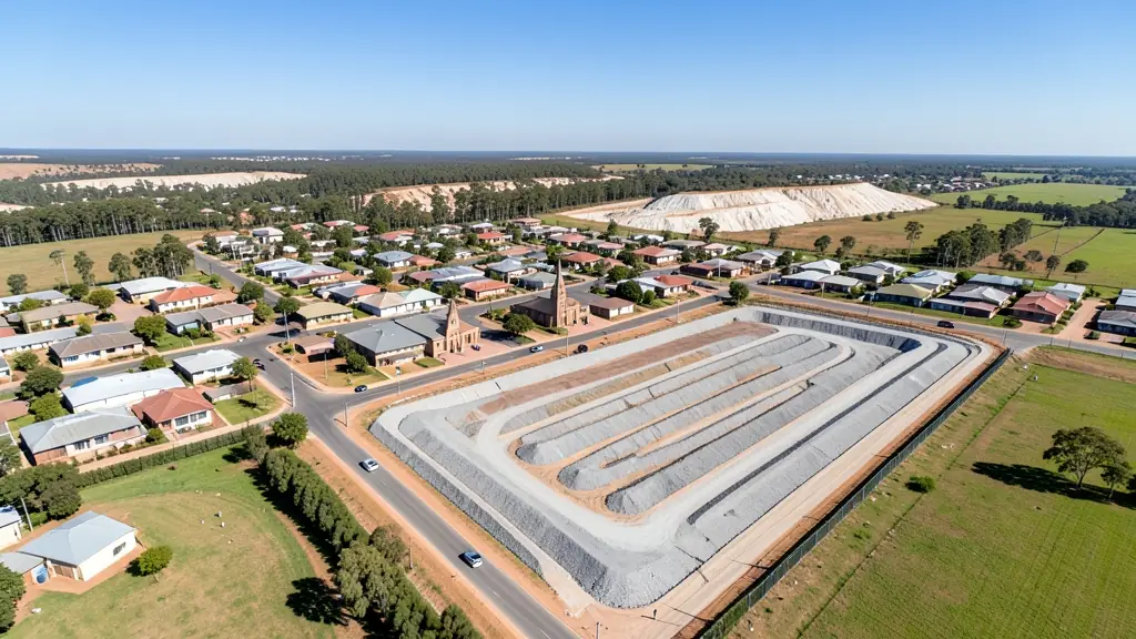
Licensed operators fly volume and stockpile surveys on tailings dams between Randfontein and Westonaria, and environmental teams use repeat aerial photos to track dust, erosion and rehabilitation. Farms on the western edge of the municipality ask about crop health mapping, and a few about spraying. Ask any mine service provider for the RPL, ROC and proof of insurance, and whether they can deliver data in the format your surveyor or engineer already uses.
Randfontein from the air
Randfontein grew around gold, and its drone work still looks at the ground. Tailings dams, old shafts and rehabilitated mine land around the town and toward Westonaria are surveyed and photographed for monitoring, reprocessing and closure plans. To the west, farms and smallholdings ask about crop health mapping and spraying. In town the market is more modest: first drones for families in Greenhills, roof checks on homes and the odd school or church event. The open veld brings stronger winds than the suburbs further east, and summer storms with lightning roll across quickly. Dust off the dumps can be heavy on dry winter days, which hurts both visibility and motors.

Who asks for drone surveying and mapping around Randfontein, most often first:
- Mines, plants and utilities: stockpile, pit and tailings volumes for mines, quarries and bulk storage yards
- Farmers and growers: field boundaries, contours and drainage maps for planning lands, dams and roads
- Municipalities, schools and NGOs: aerial mapping for municipal planning, informal settlement upgrades and roads
Local tips for Randfontein
Popular here: tailings and mine land surveys, plus crop mapping on western farms. Ask each supplier about this: for mine sites, ask whether the operator has done mine safety inductions before. Where they work from: few local shops; operators from Krugersdorp and Roodepoort cover the town.
Drone Surveying and Mapping usually suit sites, mines, farms, roads and developments, done like this: grid flights processed into maps and models. For mines, plants and utilities, the biggest group here, that usually means stockpile, pit and tailings volumes for mines, quarries and bulk storage yards. On the weather side: windy open veld, dusty dry winters and fast summer storms.
Service area: Randfontein and surrounds
Requests from Randfontein go to shops and pilots who already work in Greenhills, Randgate, Mohlakeng, Toekomsrus, Westonaria, Krugersdorp, Azaadville and the rest of the area. Mention an estate's rules or a nearby airfield, because they change how a flight is planned.