
Overview of Unmanned Aerial Systems
Definition and evolution of unmanned aerial systems
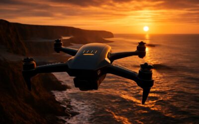
Across the world, the number of operational drones and unmanned aerial vehicles has surged by more than 100% in the last five years, and the sky now feels crowded with possibility. I watch the silhouettes skim rooftops and break the horizon with a whisper of rotors, as if the air itself keeps a diary of our ambitions!
Unmanned Aerial Systems (UAS) describe the full ecosystem—the aircraft (UAVs, or drones), the control station, and the data link that binds pilot to payload. A UAS is not mere metal; it’s a working thread of planning, flight, capture, and processing that stitches moments into actionable insight.
- Manual piloting era
- Autonomy with sense-and-avoid
- AI-driven payloads and coordinated swarms
From tethered remotes to autonomous flight, the evolution of UAS has marched in three acts: control to independence, sensors that see in the dark, and data pipelines that turn images into decision-ready intelligence. In South Africa, regulation and opportunity share one horizon, shaping the craft as much as the craft shapes our cities.
Key components of drones and UAV platforms
Airframes, propulsion, control systems—these are the core of any drone. In South Africa, 60% of aerial data projects now rely on drones and unmanned aerial vehicles to capture fast, accurate information, replacing days of field surveys with a single flight. Drones and UAVs turn terrain, weather, and timing into usable insight, helping teams plan with clarity and act with speed.
- Airframe and propulsion
- Power and endurance
- Flight control
- Sensors and payloads
- Data link
Key components of a drone platform map the capability matrix. The airframe decides wind handling and endurance; propulsion and power govern thrust and run-time; the flight controller ties sensors, navigation, and autonomy together; the data link keeps control and payload in sync; and the payload—camera, LiDAR, or thermal sensor—defines the mission’s value.
Together, these parts turn a platform into a data tool. For readers in SA, choice hinges on mission type, regulatory context, and how data is stored and shared. The result is reliable, actionable intelligence delivered from the air.
Types of drones: consumer, professional, and industrial
In South Africa, 60% of aerial data projects now rely on drones and unmanned aerial vehicles to replace days of field surveys with a single flight. The effect is a swift, almost witty conversion of terrain into tangible insight, with data arriving on a breeze rather than a back-breaking trek across veld.
Overview of Unmanned Aerial Systems reveals three broad families:
- Consumer drones: approachable, compact, and perfect for hobbyists, casual shoots, and light surveying.
- Professional drones: weather-ready, with higher-end cameras and reliable sensors for accurate mapping and inspections.
- Industrial-grade machines: heavy lifters built for large-area campaigns, autonomous missions, and demanding payloads.
These tiers illustrate how airframes, cameras, and sensors turn space into data, translating wind, endurance, and autonomy into insights for teams—without theatrics, just results.
How UAVs differ from traditional aircraft
In South Africa, 60% of aerial data projects now rely on drones and unmanned aerial vehicles to replace days of field surveys with a single flight. These airframes are not mere toys; they are ethereal workhorses, turning wind into maps and terrain into tangible insight with a single, decisive sweep.
How UAVs differ from traditional aircraft boils down to four quiet advantages, often overlooked in the glare of tabloids:
- Size and cost: compact platforms that slash flight-time budgets and insurance burdens.
- Autonomy: mission planning and hands-off execution that free human teams for strategy, not routine piloting.
- Sensor fusion: multispectral cameras, LiDAR, and thermal tools that harvest richer data at ground level.
- Safety and airspace: built-in geofencing, failsafes, and real-time telemetry that keep operations compliant.
In the end, these airframes weave knowledge from air, turning weather into workflow without theatrics—only results.
Global market trends and adoption across sectors
The market for drones and unmanned aerial vehicles is humming with double-digit momentum, turning the horizon into a data farm!
Across sectors, adoption is broadening—from agriculture to energy, from infrastructure inspection to media production—because aerial insight pays per flight. In South Africa, mining corridors, agricultural blocks, and conservation projects are already weaving UAVs into their workflows.
- Agriculture and farming
- Mining and infrastructure
- Energy and utilities
- Film, media, and inspection
The trend is powered by smarter sensors, longer flight times, and safer autonomy, a quiet revolution that lets manual labor step back while strategy takes the lead. I’ve seen operators in Cape Town and Johannesburg bend schedules to weather windows and still harvest richer data, faster.
Regulations, safety, and compliance
Licensing and certification requirements by region
Regulations aren’t roadblocks—they’re lifelines. In South Africa, the skies belong to drones and unmanned aerial vehicles that fly with purpose and precision, not guesswork. A well-placed license can turn a high-stakes flight into smooth operation.
Licensing and certification vary by region but share a core aim: safety, accountability, and traceability. South Africa’s Civil Aviation Authority requires registration, a remote pilot license for commercial work, and operator approval for RPAS flights. Across the world, Europe follows EASA standards, the United States relies on the FAA framework, and the UK maintains its own regime—each prioritizing risk assessment and flight planning.
- South Africa: registration, remote pilot license (RPL), RPAS operator approval
- Europe: EASA-based licensing with country-specific adaptations
- United States: FAA rules and waivers for commercial use
Safety disciplines—pre-flight checks, airspace awareness, and incident reporting—anchor every mission. When drones and unmanned aerial vehicles operate under proper licensing, documented procedures, and rigorous logs, the sky feels more controlled than chaotic.
Airspace classifications and permit processes
The sky is getting busier every year, and drones and unmanned aerial vehicles are changing how South Africa works—safety isn’t a nicety, it’s the baseline. Regulations shape every mission, guiding pilots toward accountability, traceability, and reliability. A disciplined safety ethos—pre-flight checks, airspace awareness, and incident reporting—transforms potential chaos into calm, controlled operations!
Airspace classifications and permit processes sit at the heart of responsible use. Operators navigate zones, altitude limits, and aerodrome proximity, balancing risk with opportunity. The system favors transparency and tuned planning over improvisation, even as the skies become a shared workplace.
- Understand airspace designations and restrictions
- File flight plans and risk assessments where required
- Secure the necessary authorization before flight
With this framework, the experience of flying emerges as purposeful and trustworthy, reflecting a mature market where such platforms support industry while honoring public safety.
Privacy, safety, and ethical considerations for UAV operations
The sky is a governed realm where risk meets responsibility. In South Africa, regulations choreograph every ascent of drones and unmanned aerial vehicles, turning ambition into dependable practice. Compliance acts as a compass, not a hurdle.
Privacy, safety, and ethics anchor UAV work. Respect bystanders, secure consent, and minimize data collection. Geofencing and transparent incident reporting guard communities while innovation thrives, guided by POPIA and norms.
- POPIA-aligned data handling and retention policies
- Consent and notification for imagery collection
- Transparent incident reporting and traceability
Regulations cultivate a safety culture: pre-flight checks, risk assessments, and meticulous record-keeping become second nature. Accountability turns uncertainty into calm skies and cooperative relations with airspace neighbors.
Fleet management and routine maintenance standards
In South Africa, regulations mold every flight for drones and unmanned aerial vehicles, turning ambition into dependable practice. A compliance-first mindset keeps operations predictable and accountable. Regulations foster a safety culture where pre-flight checks are routine, risk assessments are documented, and records stay meticulous, so neighbours and operators share calm skies!
Fleet governance follows clear standards that ensure reliability across the fleet.
- Centralized flight logs and maintenance records
- Calibration and testing cadence for sensors, propulsion systems, and structural integrity
- Lifecycle tracking and parts replacement policies
- POPIA-aligned data handling and retention policies
These governance elements reduce downtime, improve traceability, and keep operations aligned with the South African airspace.
Data security and cyber resilience for unmanned systems
SA skies are evolving with a compliance-first approach. Regulations steer every flight for drones and unmanned aerial vehicles, turning ambition into dependable practice. Safety takes center stage—pre-flight checks, risk assessments, and meticulous records aren’t optional. That discipline keeps neighbours and operators sharing calm skies.
Data security and cyber resilience are the unseen wings of modern flight. Data in transit and at rest must be protected as fleets scale and operations rely on remote portals.
- End-to-end encryption for flight data and telemetry
- Multi-factor authentication and least-privilege access
- Continuous monitoring and tested incident response
Governance that prioritizes security also shortens downtime and enhances traceability across the fleet. When cyber risks are managed, the airspace remains trustworthy for people and business alike.
Applications across industries
Agriculture and precision farming applications
South Africa’s farms rewrite the weathered tale of yield with a silent observer. Drones and unmanned aerial vehicles deliver maps that feel prophetic—showing where irrigation, fertilizer, or cover crops will do the most good. In the last year, farmers reported water-use reductions around 30%, turning scarce resources into strategic advantage.
From the air, fields reveal patterns the naked eye misses: early stress in crops, nutrient gaps, moisture pockets. Precision farming uses these signals to tailor inputs, reduce waste, and boost environmental standards.
- Crop-health and stress detection through multispectral imagery
- Soil moisture and nutrient mapping for informed irrigation decisions
- Variable-rate application of fertilizers or pesticides
- Pest and disease scouting to catch outbreaks before they spread
As dawn breaks over the Karoo or the Free State, drones and unmanned aerial vehicles become a quiet advantage—turning data into harvest and resilience for South African farms.
Construction, surveying, and mapping workflows
“A single drone flight can replace days of on-ground surveying,” a veteran site lead once told me, and the truth lands with authority across South Africa’s construction, surveying, and mapping projects. Drones and unmanned aerial vehicles morph air into a precise information channel—capturing sites from above and turning that view into actionable data.
From verticality to complexity, they deliver accurate topographic maps, as-built models, and volumetric data for earthworks and materials management. Real-time imagery feeds BIM workflows, improves safety planning, and accelerates permit processes, letting teams coordinate more tightly with engineers, architects, and clients.
- Topographic surveys and contour generation
- Progress tracking and earned-value reporting
- As-built documentation and change detection
Emergency response, search and rescue, and public safety
Across South Africa’s emergency landscapes, aerial intel becomes a catalyst for courage. Drones and unmanned aerial vehicles offer that overhead lens, turning noise into maps and urgency into actionable clues. In real deployments, scene assessment times shrink by as much as 40%, letting responders arrive with clarity rather than conjecture.
From wildfire spread to urban search and rescue, they scan inaccessible terrain, stream live video, and relay thermal data that guides teams to survivors before the cold dawn ends the window. For public safety, drones and unmanned aerial vehicles deliver rapid scene assessment with real-time feeds to incident command.
- Rapid situational awareness through live video, 3D mapping, and data integration.
- Thermal imaging and multispectral sensors to detect heat, movement, and hazards.
- Coordinated incident command with shared geospatial data for safe, controlled operations.
In crises, human judgment remains the compass guiding every flight of drones and unmanned aerial vehicles.
Entertainment, cinematography, and media production
In the theatre of South Africa’s visual storytelling, aerial capture has become a trusted co-director. Drones and unmanned aerial vehicles unlock sweeping vistas and intimate motion in a single breath, and productions report up to 30% shorter setup times. From sunlit coastlines to urban canyons, the sky frames narrative tempo with a rare authority, turning light into texture and distance into drama!
- Establishing shots with expansive scale that set mood
- Heroic tracking and dynamic aerial choreography for action
- Integrated color and post-production workflows using stabilized feeds
Behind these images lies craft and care: flight planning, safety margins, and a sense of rhythm that translates across screens, from streaming shorts to feature-length dramas.
Environmental monitoring and scientific research
In environmental monitoring, drones and unmanned aerial vehicles map coastlines, monitor wetlands, and track microclimates with a quiet precision.
Across scientific frontiers, these platforms enable fieldwork that is faster, safer, and more comprehensive. Consider the following applications:
- Habitat and biodiversity surveys across fragile ecosystems
- Pollution plume tracking in rivers and estuaries
- Atmospheric sampling and microclimate data collection
- Coral reef health assessment and coastal erosion monitoring
In South Africa, these aerial tools transform observations from remote savannas to coastal research stations into enduring knowledge for conservation, science, and policy.
Technology, sensors, and capabilities
Autonomy, AI-assisted flight planning, and navigation
In the world of drones and unmanned aerial vehicles, technology is the pilot. More than 60% of aerial surveys now rely on autonomous flight planning, turning complex data into actionable insight fast. This shift accelerates projects across South Africa’s diverse landscapes, from coastal ports to inland mines.
Technology and sensors drive capability. High-resolution optics, multispectral and thermal sensors, and LiDAR fuse with avionics to deliver precise data in all conditions. Payload versatility lets teams tailor sensing to map terrain, inspect infrastructure, or monitor environmental indicators.
Autonomy, AI-assisted flight planning, and navigation redefine control. AI helps plan routes, optimize energy use, and adapt to wind shifts or sudden hazards. Core capabilities include:
- AI-driven route optimization
- Real-time obstacle detection and avoidance
- Sensor fusion for robust positioning
Navigation relies on GPS and map data to keep missions on course, with safety features and geofencing guiding responsible flight for drones and unmanned aerial vehicles.
Imaging, sensing, and payload options
Technology and sensors are the heartbeat of drones and unmanned aerial vehicles. Modern platforms boast modular payload bays, swappable optics, and rugged enclosures designed for dusty mines or coastal winds. Real-time data streams empower teams to translate complex scenes into actionable insights on the fly, accelerating decision-making in mission-critical contexts. Across South Africa’s diverse environments, the sensor suite you choose often dictates what’s possible—from precise topographic maps to rapid hazard assessment.
Imaging, sensing, and payload options give crews the freedom to tailor missions for terrain, infrastructure, or environmental monitoring.
- High-resolution RGB and near-infrared cameras
- Multispectral, hyperspectral, and thermal sensing
- LiDAR and radar payloads for precise 3D data
Together, these options expand the reach of teams in mining, ports, and rural installations across SA.
Collision avoidance, sense-and-avoid systems, and safety features
In a sky where one misread signal can turn a routine survey into a headline, drones and unmanned aerial vehicles live on their wits—and their sensors. Collision avoidance and sense-and-avoid systems weave together optical cameras, LiDAR, radar, and enhanced GPS to detect hazards in real time, bolstered by safety features built for dusty mines and coastal gusts.
- Redundant sensing: multi-path data fusion from cameras, LiDAR, and radar
- Geofencing and automatic return-to-home for loss of signal
- Collision avoidance algorithms with fail-safe braking or hover
- Emergency landing and automatic system health checks on the fly
These capabilities amplify the reach of projects across mining, ports, and rural installations in SA, translating complex scenes into actionable insights without friction for drones and unmanned aerial vehicles.
Battery technology, endurance, and power management
Power is the new payload—say it loud, say it clear! In South Africa’s sun-baked landscapes, flight time is the margin between a usable map and a thwarted mission. For drones and unmanned aerial vehicles, battery chemistry, endurance, and smart power management decide whether data lands in time or drifts into the static of the telemetry feed.
From high-density LiPo cells to solid-state contenders, the field edges toward lighter packs and faster swaps. Endurance grows when power routing favors essential sensors, and when flight software gates noncritical loads.
- Modular, hot-swappable battery packs
- Thermal-aware management and predictive maintenance
- Power-aware flight planning and duty-cycling
South Africa’s mining, agriculture, and infrastructure work benefits from these leaps in power stewardship—keeping these platforms aloft longer and mapping more with less downtime.

0 Comments