
Drone Surveillance Technology Overview
What Is Drone Surveillance Technology
Airspace over city centers is no longer a luxury; it’s a data corridor. One veteran security director put it this way: ‘If you can’t measure it, you can’t manage it.’ This mindset underpins the growing role of surveillance drones in South Africa’s security and infrastructure landscape!
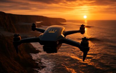
Drone surveillance technology blends high-resolution cameras, night-vision, thermal imaging, and AI-based analytics. Outputs from these systems feed real-time data to command centers and GIS maps, turning raw footage into actionable insight. Compliance with POPIA and local privacy norms anchors deployments across urban and rural South Africa.
Core capabilities include:
- Real-time imagery and analytics
- Night vision and thermal sensing
- Data fusion with ground systems
South Africa’s use of aerial oversight balances safety gains with civil rights, shaping deployments that protect assets while respecting privacy.
Key Components: Cameras, Sensors, and Communication
Across South Africa’s skylines, surveillance drones have turned urban airspace into a living data corridor. Each flight yields imagery that hints at security gaps, asset wear, or crowd dynamics—if you know how to read it. The key drivers are cameras, sensors, and robust communication.
- Cameras: high-resolution, adaptive exposure, and optical zoom
- Sensors: infrared, thermal, radar, and environmental data
- Communication: secure data links, command-control channels, and redundancy
From flight to frontline decisions, this trio turns raw footage into trusted signals for security operators. In South Africa, robust links and data fusion keep the stream coherent, even under variable conditions, while privacy norms temper the pace of progress.
Industry Sectors Benefiting from Aerial Monitoring
From the black glass of city nights, surveillance drones translate the pulse of the street into data you can trust. In the numerical quiet between a siren and a streetlight, decisions crystallize. “We chase the edge of uncertainty and catch it,” a veteran operator once said.
Across South Africa, aerial monitoring touches many sectors, turning remote views into frontline advantages. Key beneficiaries include:
- Mining and resource operations
- Utilities and critical infrastructure
- Public safety, crowd management, and emergency response
- Agriculture and land stewardship
- Transport hubs and logistics networks
From corridors of light to the halls of decision, this aerial insight becomes a clear beacon for risk assessment and strategic planning. In this twilight discipline, intent and reality intertwine, yielding a map you can trust.
Differences Between Drones and Traditional Surveillance
Streets glow with neon and data, and in that glow the drone is not a gadget but a question—how much certainty does altitude grant, and at what cost to privacy? Surveillance drones turn movement into measurable insight, a leap from gaze to evidence that can be trusted in the quiet hours of risk assessment.
Differences between drones and traditional surveillance are not merely technical; they are philosophical. Fixed cameras confess only what they see; drones, with agile flight, become storytellers of motion, time, and context—capturing multi-sensor data that can be interpreted in seconds rather than days.
- Mobility expands coverage beyond fixed frames
- Real-time aerial perspective accelerates decision making
- Sensors fuse optics, thermal, and radar for richer context
- Governance, privacy, and data security shape deployment
That shared horizon—where mobility meets responsibility—defines the evolution of surveillance in the urban arena.
Applications and Use Cases
Public Safety and Law Enforcement Applications
Public safety teams rely on surveillance drones for eyes in the sky that don’t blink. In South Africa’s bustling cities, real-time aerial feeds can trim incident response times by as much as 30%, turning panic into coordinated action rather than pileups of chaos.
Applications and use cases for public safety and law enforcement include:
- Large-event monitoring and crowd management
- Search and rescue in difficult terrain
- Traffic incident assessment and rapid route clearance
- Disaster response, situational awareness, and after-action mapping
These tools sharpen judgment, helping agencies balance safety with privacy and accountability, and they adapt to urban sprawl, rural routes, and everything in between.
Industrial Monitoring and Asset Inspection
Across South Africa’s vast industrial heartland, surveillance drones are reshaping asset care—slashing inspection cycles by up to 40% and delivering real-time visibility that ground crews once only dreamed of.
From pipelines and substations to sprawling solar fields, these machines capture high-resolution imagery, thermal data, and LiDAR. They reveal corrosion, overheating, or misalignment long before a fault becomes costly, guiding safer, smarter maintenance decisions.
- Pipeline integrity checks
- Asset performance in renewables
- Construction and site monitoring
Environmental Surveillance and Wildlife Monitoring
Across South Africa’s wilderness, surveillance drones are turning instinct into data. A single flight can map hundreds of square kilometres in hours, turning what used to take days into near real-time insight. They transform nocturnal shadows into actionable information, guiding conservation teams with a quiet, watchful presence.
From tracking endangered species to mapping fragile wetlands, these tools extend our senses without disturbing the wild. Their payloads—high-resolution cameras, multispectral sensors, and thermal imagers—reveal habitat changes, migrations, and threats before they escalate.
- Anti-poaching patrols and rapid deterrence
- Habitat health assessment via multispectral imaging
- Nesting site monitoring and population surveys
By weaving bright data into conservation planning, these technologies help secure South Africa’s natural heritage for generations to come.
Regulatory, Privacy, and Ethical Considerations
Privacy Rights and Data Protection
The sky watches, and the law is catching up. In South Africa, the use of surveillance drones prompts a careful balance between security needs and protecting personal privacy.
Regulatory frameworks, including POPIA and aviation standards, insist on transparency, purpose limitation, and robust data safeguards for surveillance drones. Operators face accountability measures that tie footage handling to clearly defined objectives.
- Data minimization and purpose limitation
- Notice, consent, and limited sharing
- Access controls and audit trails
- Retention limits and breach response
As a policy-minded writer, I see privacy rights that empower residents to be informed, access records, and challenge processing when necessary, while upholding proportionality in monitoring.
Ethical vigilance remains essential as technology evolves; transparency, accountability, and community engagement should guide every flight.
Aviation Regulations and Compliance
South Africa’s skies are no longer just a stage for birds; they’re a corridor of accountability, with regulated drone operations rising by 28% last year. Surveillance drones are fueling this uptick, and SACAA and POPIA insist on licensing, flight planning, and transparent data handling. It’s a careful dance: security gains must be balanced against privacy expectations, and regulators demand a clear objective for every mission. I’ve seen how governance threads keep the conversation human even as the gadgets gleam.
- Licensing and operator proficiency under SACAA rules
- Structured flight planning with proper airspace awareness
- Incident reporting and audit trails to ensure accountability
Ethical vigilance should accompany every flight; transparency, proportionality, and community engagement build trust in the long run, even as surveillance drones push the boundaries of what’s technically possible. I’ve learned that governance is as important as gadgetry.
Ethical Implications and Public Trust
In South Africa, the regulatory airspace for surveillance drones has teeth. Licensing, structured flight planning, and incident reporting come with SACAA and POPIA oversight, and the numbers reflect it: a 28% uptick in regulated drone operations. It’s a delicate balance between capability and accountability.
Privacy considerations guide every flight, demanding purpose limitation, minimization, and robust data protection. When surveillance drones capture images in public or semi-public spaces, operators must justify retention periods and secure storage; the rulebook insists on transparent handling.
Ethical vigilance should accompany every flight. Public trust is earned by transparency, proportionality, and active community engagement.
- Transparent disclosure of objectives and data flows
- Proportional data collection and minimal retention
- Accessible channels for oversight, feedback, and redress
Policy Trends and Global Variations
Surveillance drones are reshaping how communities watch the skies, and policy is tightening. In South Africa, a 28% uptick in regulated drone operations signals a future where permission, planning, and reporting are routine. Globally, trends favor clear licensing, risk-based flight approvals, and privacy-first guardrails that protect legitimate use and everyday life.
Three guiding pillars stand out:
- Transparent disclosure of objectives and data flows
- Proportional data collection and minimal retention
- Accessible channels for oversight, feedback, and redress
Across continents, policy approaches vary, but the heart remains the same: protect individuals, respect property, and trust the professionals who pilot drones. South Africa blends local oversight with global best practices, while Europe and North America push for stronger data localization. In any region, ethical vigilance and a clear, accountable footprint make the difference for communities watching the skies.
Technology, Capabilities, and Trends
Autonomy, AI, and Computer Vision
Technology is no longer a backdrop; it’s the cockpit. surveillance drones fuse compact sensors, encrypted links, and rugged cameras into a single, agile observing platform. More than 60% of security teams report faster incident response with real-time feeds, turning data into action in minutes. In South Africa’s diverse landscapes, this automation redefines risk and response.
Capabilities are the heartbeat: autonomy for mission planning, on-board AI for real-time judgments, and computer vision that spots anomalies before a blink. These tools turn scattered data into decisive action and smarter asset oversight.
- Autonomy for hands-free navigation and safe route planning
- On-board AI for real-time analytics and anomaly detection
- Computer vision for object recognition and scene interpretation
Trends toward greater Autonomy, more capable AI, and sharper Computer Vision are reshaping expectations. Edge processing slashes latency, while governance and privacy safeguards gain salience in South Africa’s diverse airspace. The result is a more trustworthy, resilient drone-enabled vision of public safety and industry oversight.
Sensor Suites and Image Quality
Technology isn’t a backdrop anymore; it’s the cockpit. In field deployments, compact sensors, encrypted links, and rugged cameras fuse into one nimble eye in the sky. surveillance drones transform data streams into actionable insight, delivering real-time feeds that keep teams in South Africa agile and informed.
Capabilities are the heartbeat: autonomy for hands-free navigation, on-board AI for rapid analytics, and computer vision that flags anomalies before a blink. These tools turn scattered streams into decisive action and smarter asset oversight across industries.
Trends toward greater autonomy, more capable AI, and sharper computer vision are reshaping expectations. Edge processing slashes latency, while governance and privacy safeguards gain salience in South Africa’s diverse airspace, pushing image quality and sensor suites to the frontline.
Integration with Ground Support Systems
South Africa’s field ops reveal a striking truth: when surveillance drones feed live visuals into solid ground support systems, decisions snap from hours to minutes. The sky becomes a cockpit—the entire operation in one nimble eye.
Capabilities beat at the core: autonomous navigation frees hands, onboard AI decodes streams, and computer vision flags anomalies. This harmony links air with ground through dashboards, alerts, and seamless workflows.
- Mission planning integrated with local ops
- Real-time telemetry and health checks
- Secure, low-latency data links
Trends toward greater autonomy, sharper AI, and improved computer vision push edge processing forward, reducing latency. In South Africa’s diverse airspace, governance and privacy safeguards become accelerants rather than obstacles.
Future Trends: Edge Computing and Connectivity
In field trials, edge-enabled surveillance drones slashed decision latency from hours to minutes—by nearly 40% in dynamic environments. That pivot turns the sky into a live cockpit for the ground team.
Technology is shifting toward edge computing and smarter connectivity. When processing happens on the craft or near the edge, streams are filtered, compressed, and prioritized before leaving the airspace. I’ve seen teams filter data on the fly, and the result is clarity where it counts. You get real-time situational awareness even where networks sag. In South Africa’s varied terrain, resilient links—5G, satellite, or mesh—keep data flowing between platform and base.
- Low latency
- Bandwidth efficiency
- Offline operation
Future Trends: Edge Computing and Connectivity point to a tighter fabric of intelligence. More workloads stay onboard, networks blend urban and rural coverage, and encrypted, resilient links become the norm—keeping surveillance drones steadily informed as they roam.

0 Comments