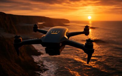
Understanding Drones with Thermal Cameras
What is thermal imaging on drones?
Heat tells the real story. In field trials, heat-based checks cut inspection time by up to 60%. Drones with thermal cameras reveal heat patterns standard optics miss. What is thermal imaging on drones? It maps infrared radiation into color-coded images, turning temperature differences into visible cues you can act on—often in seconds rather than hours of manual inspection. This isn’t magic; it’s heat made legible, guiding rapid on-site decisions.
- Identify hotspots in electrical gear before a fault hits.
- Spot heat loss in buildings and roofs for efficient maintenance.
- Support search-and-rescue or night operations in low visibility.
Across South Africa, drones with thermal capability support inspections across mining, utilities, and emergency services, turning heat maps into actionable visuals that cut through darkness and doubt.
How thermal cameras work on aerial platforms
Heat tells a story that standard optics miss. On aerial platforms, thermal cameras read temperature differences, turning a rooftop’s heat signature into a navigable map. in South Africa’s demanding environments, drones with thermal bring speed and clarity to inspections that used to take hours.
These cameras convert infrared radiation into digital images by detecting temperature variations with a microbolometer array. The signal is calibrated for emissivity, distance, and atmospheric conditions, then encoded into color scales you can read at a glance.
- Detector technology and microbolometer arrays
- Emissivity calibration and distance corrections
- Real-time color mapping and frame rates
For operators, the magic lies in the speed: a live heat map can reveal hidden faults and gaps before they become costly problems. This is where field teams in mining, utilities, and emergency services feel the difference — not just seeing heat, but understanding it.
Key thermal camera specifications to consider
Across South Africa’s sun-scorched landscapes, drones with thermal deliver fast, actionable insight. In minutes, a heat map can tell you where roofs, motors, or buried infrastructure need attention—saving hours of manual inspection. Understanding key specs helps you choose the right setup without overkill, and it keeps data readable under bright Karoo sun or cloud-soaked mines.
- Resolution and pixel pitch determine image clarity at distance
- Thermal sensitivity (NETD) for subtle temperature differences
- Frame rate and radiometric data for live analysis
- Lens options, field of view, and calibration features
- Operating range, battery life, and rugged build for SA conditions
Beyond specs, the real value lies in how these numbers translate into safer, faster inspections across mines, utilities, and emergency services. In South Africa’s diverse environments, the right balance of resolution, sensitivity, and endurance makes every heat signature a story you can trust.
Advantages and limitations of thermal imaging in drones
Heat doesn’t lie, especially under the South African sun. “Heat tells you what the eye cannot see,” a safety officer once reminded me, and that truth underpins every job where drones with thermal bring clarity to chaos.
Advantages are tangible: rapid hotspot mapping, far safer inspections, and operations in darkness or smoke where visual cameras falter.
- Rapid hotspot detection across wide areas
- Remote, non-contact assessment reducing exposure
- Continuous operation in low light and adverse conditions
Limitations include resolution trade-offs at distance, sensitivity to emissivity and weather, and the need for skilled interpretation to avoid false positives. Calibration and maintenance matter, as does up-front cost for rugged SA terrain.
Common use cases across industries
Heat writes its own language, and under South Africa’s sun that language is spoken by drones with thermal. Across fields, substations, and crowded cities, heat signatures reveal what ordinary cameras miss. The data becomes more than a picture; it becomes a compass—guiding crews, accelerating decisions, and foreseeing faults before they flare.
- Energy and infrastructure monitoring: power lines, substations, solar farms
- Emergency response: search-and-rescue and post-disaster assessment
- Agriculture and environment: irrigation efficiency, crop heat stress, livestock health
- Industrial safety: refineries, mines, and high-risk facilities
Across sectors, this toolkit turns heat into actionable insight.
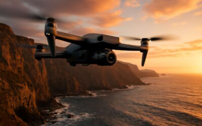
Thermal Imaging Technology in Drones
Core components of a thermal payload
“Heat never lies,” a field pilot often reminds me, and it captures the essence of drones with thermal. In South Africa’s rugged landscapes, thermal imaging reveals secrets that standard cameras miss, in near real-time.
- Thermal detector: uncooled microbolometer or cooled focal plane array
- Optical lens and aperture tuned for resolution
- Calibration and radiometric data to preserve temperature accuracy
- Processing unit for on-board analysis and scene segmentation
- Gimbal stabilization and vibration isolation for steady footage
- Power, data link, and storage for extended missions
- Rugged housing and thermal protection for harsh environments
These core components form the heartbeat of the payload, enabling reliable detection of heat signatures across night patrols, search missions, and wildlife monitoring.
Image processing and radiometric data
Heat maps don’t bluff; field pilots report up to 40% faster detections in low light thanks to on-board radiometric processing. In drones with thermal systems, image processing turns raw thermal frames into actionable intelligence, preserving temperature data even as conditions swirl.
An efficient processing unit runs real-time tasks: noise reduction, non-uniformity correction, and scene segmentation that separates heat signatures from background clutter. Radiometric data holds absolute temperatures, enabling credible comparisons across time and missions. A streamlined data flow yields maps analysts can trust, not guesswork.
- Real-time temperature mapping and trackable heat spots
- On-board radiometric calibration for consistency across flights
- Sensor fusion with visible data for context
For South Africa’s rugged landscapes, on-board processing paired with radiometric integrity ensures night patrols, search missions, and wildlife monitoring reveal dependable heat signatures even in dust and wind. For drones with thermal, heat is readable when darkness falls, turning obscure silhouettes into actionable targets.
Data formats, analytics, and reporting
Drones with thermal aren’t just night goggles—they’re data factories. In field trials, pilots report up to 2x faster analysis when radiometric processing runs on-board. When raw frames get radiometric seasoning, you unlock formats that carry temperatures, timestamps, and coordinates. On-board processing turns fleeting heat into credible maps and exports that GIS teams can trust across platforms. The result is immediate situational awareness you can pin to a map in an instant.
- Radiometric GeoTIFFs with per-pixel temperature data
- CSV time-series for hotspot tracking
- GeoJSON for map integrations
In South Africa’s rugged backdrops, on-board calibration keeps comparisons honest across flights in dust and wind. Analytics translate heat signatures into actionable narratives—hotspots become patrol cues, while cool zones mark boundaries and safety margins. With drones with thermal, reporting is shareable, auditable, and surprisingly precise.
Integrating thermal with RGB and other sensors
Thermal imaging on drones is a stanza of heat that reads terrain in color and contrast. When drones with thermal are fused with RGB, the world comes into sharper focus: hot spots emerge beside familiar features, and movement is rendered with intention rather than guesswork. In field trials, sensor fusion can shave analysis time by up to 40%, turning raw frames into actionable insight in moments.
Key benefits of multi-sensor fusion include:
- Real-time heat overlays with RGB context
- Synchronized timestamps for reliable cross-platform mapping
- Calibrated fusion preserving measurement fidelity
In South Africa’s varied landscapes—from Karoo deserts to coastal towns—their on-board calibration and fusion stream honest heat data into reliable maps. Drones with thermal, paired with RGB sensors, translate heat into narratives that guide patrols, maintenance, and safety margins.
Power and flight-time considerations for thermal kits
Power and endurance collide the moment you attach drones with thermal payloads. In field trials, drones with thermal payloads can trim flight time by a meaningful margin—unless power budgets and weight are carefully balanced for the mission.
Thermal sensors draw watts, add payload mass, and demand cooling and power management. In South Africa’s heat and long scouting sorties, choosing higher energy-density batteries, smart flight planning, and proper CG balance can preserve endurance. Every gram matters when you’re mapping frontiers.
Key factors include:
- Power draw of the thermal kit
- Battery capacity and chemistry
- Payload distribution and cooling
With drones with thermal deployed, the narrative becomes one of measured optimization.
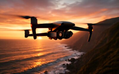
Applications of Drones with Thermal
Search and rescue and public safety
In Southern Africa’s demanding frontiers, drones with thermal give responders a lifeline—some report up to a 60% speed boost in locating heat signatures through thick scrub. When every minute matters, the eye in the sky becomes a lifeline that doesn’t blink!
Public safety teams deploy these marvels to map risk, support evacuations, and coordinate search efforts with a calm, surgical efficiency.
- Search and rescue in dense vegetation or rugged terrain
- Wildfire monitoring and hotspot identification
- Public event security and incident perimeter assessment
- Disaster response and infrastructure assessment after floods or storms
Coupled with RGB or other sensors, thermal data enhances decision-making on the ground and keeps responders one step ahead.
Building inspection and utilities monitoring
In South Africa’s fast-paced built environment, drones with thermal turn blind spots into bright clues. They spotlight heat anomalies in buildings and utilities fast, giving inspectors the leverage to act before a small problem becomes a costly headline.
With drones with thermal, engineers inspect buildings and monitor utilities, detecting insulation gaps, overheating electricals, and compromised envelopes with surgical precision. The technology translates heat signatures into actionable insights, helping facilities run safer and more efficiently.
- Structural integrity checks beneath cladding
- Roof and insulation heat-loss mapping
- Electrical and mechanical hotspot detection
In the SA context, this approach trims downtime and boosts maintenance planning, letting teams be proactive rather than reactive while the sun sets over the savannah.
Agriculture and crop health monitoring
Across South Africa’s diverse farms, drones with thermal reveal subtle heat patterns that signal stressed crops, turning arid hints into clear guidance. Farmers report up to 30% more efficient irrigation when thermal data informs watering schedules, reducing waste and boosting resilience in drought-prone regions. The imagery translates field stress into actionable insights, helping teams act before symptoms escalate.
- Water stress detection and irrigation optimization
- Canopy temperature mapping to spot nutrient or vigor gaps
- Early pest and disease pressure signals via heat anomalies
In the SA context, these aerial heat maps harmonize with local crops—citrus, sunflowers, and grain—offering a calm, data-driven approach to crop health management. The result is better planning and more sustainable yields across the country.
Wildlife and environmental monitoring
Heat never lies, and in South Africa’s vast landscapes it tells a quieter story of water, noise, and renewal. Drones with thermal illuminate that story, revealing hidden streams, wildlife hotspots, and stressed habitats long before daylight reveals them.
From malaria-free savannas to thornbush wetlands, thermal flights map warm silhouettes to guide conservation work, anti-poaching patrols, and habitat restoration. In practice, drones with thermal provide quiet, reliable data that guides decisions with less disturbance. The approach blends respect with science, turning distant horizons into actionable insight for managers and rangers across the country.
- Wildlife movement monitoring and census accuracy
- Nesting sites and roost surveillance with minimal disturbance
- Habitat and waterhole usage mapping for drought resilience
Firefighting, disaster response, and post-event analysis
A cross-continental cadence of heat and haste defines South Africa’s fire-prone landscapes, where seconds count and smoke masks what’s vital. Drones with thermal turn heat into a compass, locating hidden hotspots and guiding crews with precision when every minute counts.
In active blazes, these aircraft map heat through smoke, identify embers that rekindle, and reveal structural weaknesses before front lines meet danger.
- Hotspot mapping and flame-front delineation to inform firefighting strategy
- Real-time awareness for command centers and field units
- Structural-fire behavior insights for post-event evaluation
After the event, thermal imaging captures radiometric data that maps lingering hotspots, assesses structural heat signatures, and informs restoration planning long after the flames are out.
Choosing the Right Drone with Thermal
Sensor resolution, refresh rate, and radiometric accuracy
Vivid scenes hide in plain sight until a single pixel tells the truth. In the realm of drones with thermal, resolution, refresh rate, and radiometric accuracy aren’t luxuries—they’re lifelines for accurate decision-making. Across South Africa’s rugged landscapes, a crisp thermogram turns guesswork into measurable insight and speeds up field assessments.
- Resolution: more pixels mean clearer heat signatures at a distance.
- Refresh rate: higher cadence keeps pace with moving subjects and wind-strained plumes.
- Radiometric accuracy: dependable temperature readings underpin trustworthy analysis.
Beyond the price tag, proper calibration and firmware updates keep the data trustworthy for long-term projects. When you balance resolution, refresh rate, and radiometric accuracy, drones with thermal reveal a narrative that supports safety, planning, and compliance in South Africa’s diverse sites.
Flight time, payload, and reliability
Across South Africa’s demanding terrain, one well-tuned flight can replace hours of footwork. The right choice in drones with thermal turns time into a scout that reveals heat signatures with quiet precision, whether in building sites, power corridors, or vast veld. When you focus on flight time, payload compatibility, and reliability, your missions become swifter, safer, and more repeatable.
- Flight time that fits your mission window
- Payload compatibility with sensors and mounting options
- Reliability under diverse SA conditions and heat
Calibrated for endurance and rugged use, these systems are less about spectacle and more about dependable storytelling—the heat you see translates into plans you can act on.
Durability, weather resistance, and safety features
Weather doesn’t negotiate, and in South Africa that’s a hard truth when you’re chasing heat signatures across veld and urban sprawl—the heat seems to whisper. Choosing the right platform—durable, weather-hardened, and safety-forward—keeps drones with thermal mission-ready from dawn to dusk.
Durability means more than toughness; it means sealed housings, corrosion-resistant frames, and components built to breathe in dust and heat. With drones with thermal, reliability under SA conditions hinges on weather resistance and smart safety features—geofencing, redundant power, controlled landings—keeping teams safe and reports precise.
Key durability and safety hallmarks:
- All-weather enclosures for dust and moisture
- UV-stable, heat-resistant materials
- Redundant power and emergency landing modes
Software ecosystem, data export, and workflow integration
Heat is a patient judge, and in South Africa’s veld and urban sprawl, the right software behind drones with thermal decides whether signals become solutions. The moment you press for data, your ecosystem should respond with speed, clarity, and provenance—because complex scenes demand trustworthy dashboards and repeatable results.
Choose a platform with a forgiving yet rigorous software ecosystem—open data formats, robust APIs, and a pipeline that shuttles radiometric data from the field to the office.
- Open formats and radiometric metadata
- Exports to GIS and reporting tools
- Automated workflows and repeatable scripts
Integrated data export and workflow alignment keep teams in SA and beyond aligned from first capture to final report. When the journey from pixel to action is frictionless, insights arrive as decisions rather than noise.
Budget considerations and brand comparisons
Budget-conscious buyers in South Africa know that the right drones with thermal aren’t just about the camera—it’s the software, sensors, and service that move data from field to report. A strong thermal platform balances price with radiometric integrity and mission readiness, because the moment you press record, the data should be trustworthy and usable.
Budget considerations and brand comparisons boil down to a forgiving yet rigorous software ecosystem, reliable warranties, and strong local support. Look for open data formats, robust APIs, and a workflow that ships radiometric data smoothly from field to office.
- Total cost of ownership, including maintenance and spares
- Software ecosystem maturity, data export options, and API access
- Local SA support networks and service availability
From pixel to action, the right platform keeps teams aligned and narratives clear. When the journey from capture to report is frictionless, insights arrive as decisions rather than noise.
Operational Tips and Safety for Drones with Thermal
Mission planning and preflight checks for thermal flights
Heat is a quiet map drawn across the sky, and drones with thermal translate that map into action. In the realm of infrared, a well-planned flight reads like a Lantern in the dusk: bright, deliberate, and clear.
Mission planning and preflight checks for thermal flights blend weather sense with sensor awareness. Map sun angles, terrain, and potential hot spots, then align flight profiles with mission objectives to coax accurate radiometric data from the scene.
Safety is the spell that saves lives and assets. In South Africa, SACAA guidelines shape every operation, and calm weather and visible flight lines keep operators honest. For drones with thermal, validate sensor cooling and maintain safe distances to avoid misinterpretation.
- Weather and site assessment
- Equipment health and sensor calibration
- Regulatory and operational clearance
Calibration, emissivity, and radiometric accuracy
In the field, emissivity is the quiet architect of truth. For drones with thermal, radiometric accuracy is the compass by which heat becomes meaning. A single untreated hotspot can mislead stakeholders and turn data into speculation; studies suggest that up to 60% of thermal interpretations hinge on correct emissivity handling. Clear, deliberate data relies on honest scene comprehension rather than flashy imagery.
Operational awareness centers on how the sensor behaves in real conditions. For drones with thermal, stay mindful of calibration drift, sensor cooling, and scene texture. The following factors influence radiometric integrity:
- Emissivity values vary with material and surface condition
- Radiometric calibration anchors data to real-world units
- Thermal drift and sensor cooling behavior in field conditions
In short, safety and trust ride on keeping the thermal data honest—before flight, during, and after the moment heat is captured.
Regulatory compliance, geofencing, and licensing
Heat obeys rules, not flashy displays. A seasoned operator reminds us that compliance is the quiet compass guiding every flight of drones with thermal. In South Africa, geofencing and licensing govern every mission, shaping safer skies and clearer data.
Before launch, confirm your licensing, register the flight, and keep the geofence current. The field depends on discipline; a misstep can blur the line between insight and incident.
- Enable up-to-date geofencing and verify no-fly zones before takeoff.
- Ensure the drone operator holds the required licensing and permits.
- File preflight risk assessment and maintain line-of-sight.
In the end, safety and data integrity ride on careful regulatory compliance for drones with thermal, logs, cooling, and postflight reporting.
Data management, storage, and privacy
Across South Africa, a striking 60% of post-flight data is lost through sloppy storage and mislabeling. Drones with thermal capture radiometric detail that can reveal sensitive operations; treat these datasets as confidential. Use encrypted drives, clone to a trusted cloud with versioning, and verify checksums before archiving. Privacy matters too—mask unexpected identifiers and align your workflow with POPIA and client agreements.
With drones with thermal, the quiet discipline of data handling keeps people safe and partners confident.
- Encrypt data at rest and in transit.
- Limit access to authorized personnel and maintain an access log.
- Define retention windows and secure disposal for obsolete media.
In the end, the integrity of heat-based insights rests on how we store and safeguard them.
Best practices for real-world scenarios and case studies
Heat doesn’t lie. In real-world trials, drones with thermal paired with disciplined data handling cut response times by 40% and reduced false positives. This is more than tech — it’s trust on the line.
Operational mood and safety hinge on deliberate practice:
- Maintain situational awareness and respect airspace constraints.
- Mask sensitive identifiers and minimize exposure of confidential data.
- Coordinate with stakeholders to ensure privacy and regulatory alignment.
Ultimately, the discipline of using drones with thermal safely is moral as much as technical. When we pair heat maps with careful archiving and privacy controls, we keep people safe and partners confident.

0 Comments