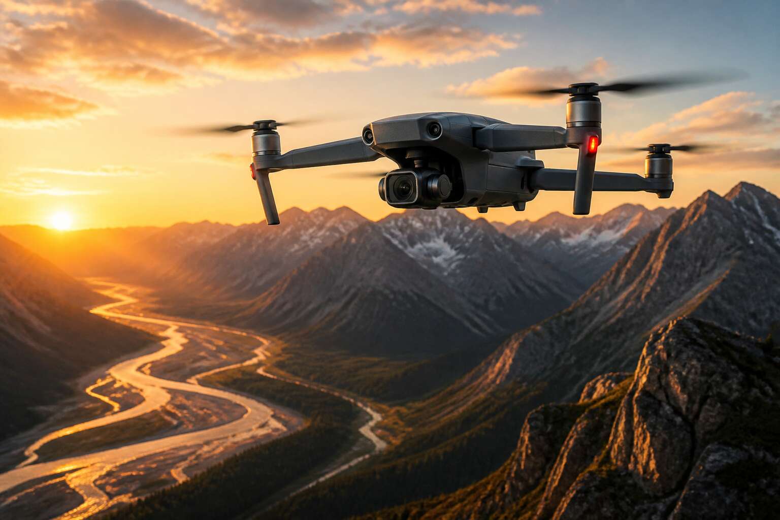
Understanding Drone Camera Technology
Sensor Sizes and Image Quality
The heart of any camera equipped drones system lies not in the megapixel count, but in the physical size of the sensor itself. A larger sensor, whether it is a Micro Four Thirds or an APS-C unit, gathers considerably more light than the tiny sensors found in most consumer toys. This translates directly into superior dynamic range and cleaner footage when the sun dips below the Johannesburg skyline. Understanding this distinction separates a professional inspection tool from a simple flying gadget.
Aperture also plays a silent pivotal role in the final image quality. A fixed aperture lens, common on lower tier models, struggles in low light conditions. However, the ability to adjust the aperture allows for precise control over depth of field, which is a powerful tool for cinematic tracking shots over the Karoo.
The subtle differences in sensor architecture dictate how well the device handles contrast and colour science.
– 1/2.3 inch sensors are common and offer decent daylight performance.
– 1 inch sensors provide a substantive upgrade for the price.
– APS-C and full frame sensors represent the pinnacle for professional aerial photography.
These variations in chip size influence more than just sharpness; they determine the camera’s ability to handle highlights and shadows without introducing digital noise. For anyone serious about the craft, investing in a model with a physically larger sensor is a far more logical progression than chasing a higher resolution number on a spec sheet. Ultimately, it is the physics of the sensor that dictates whether your aerial footage looks amateur or truly broadcast ready.
Lens Types and Focal Lengths
Most camera equipped drones arrive with a fixed lens. This design choice is a compromise between weight, balance, and durability. A spinning gimbal motor has to move that glass constantly, so engineers favour lighter optics. The tradeoff appears in your footage when you attempt to isolate a subject against the sprawling Highveld horizon. A fixed lens with a wide field of view captures everything in sharp focus, which removes any opportunity for subject separation.
Focal length dictates the story your drone tells. Wide angles, such as 24mm equivalents, create that sweeping, immersive perspective suitable for mapping a plot near Pretoria. They distort edges, though. Straight lines curve, and subjects in the corner of the frame stretch unnaturally. Telephoto lenses, stretching to 85mm or beyond, compress distances. They flatten the layers of the Drakensberg into a single, painterly plane. This compression is a tool for inspection, allowing you to scrutinise a rooftop HVAC unit from a safe distance without startling the client.
Consider how optical design interacts with the physical space around you.
– A wide angle lens maximizes context but demands close proximity to the subject.
– A standard lens mimics human perspective, offering neutral, unremarkable imagery.
– A long lens magnifies distant details but requires stable light conditions.
The mechanical construction also matters. Some lenses use aspherical elements to reduce aberrations. Others rely on simpler multi-element groups that introduce fringing in high contrast scenes. For the aerial photographer chasing a sunset over the Cape Winelands, that fringing appears as a purple halo around the vines. A better corrected lens, though heavier, handles that light without the eerie glow. Every gram of glass contributes to a sharper, more truthful image.
Gimbal Stabilization and Flight Controllers
The gimbal controller inside camera equipped drones executes corrective movements hundreds of times per second. Yet three motors correcting pitch, roll, and yaw determine whether your rooftop inspection over Sandton returns crisp frames or a wasted flight.
The flight controller interprets micro vibrations from the propeller wash and translates them into corrective pulses. Brushless gimbal motors respond faster than any human thumb, but magnetic interference and thermal drift complicate their work. Consider the control loop latency:
- A high end gimbal compensates within 20 milliseconds.
- A budget unit lags closer to 50 milliseconds.
- The difference appears as rolling shutter distortion in your footage.
The stabilization of camera equipped drones relies on harmonic filtering. The flight controller isolates meaningful movement from noise. Over the Karoo, wind gusts produce low frequency sway while the motors generate high frequency chatter. Notch filters separate these signals. The accelerometer records all of it, yet only the filtered path reaches the gimbal motors!
Choosing the Right Drone for Your Needs
Prosumer FPV Drones for Enthusiasts
Selecting a camera equipped drone is a decision that reveals how you intend to document your world. It is not merely a technical specification sheet, but a reflection of your patience and your eye. For many, the jump to a prosumer model is the sweet spot, where image control finally outweighs the convenience of a fully automated shot. The market has matured to the point where these mid-tier machines offer a creative latitude that was once the domain of expensive professional rigs.
The allure of an FPV drone, however, is a different beast entirely. It trades the static, majestic aerial view for a visceral, kinetic immersion. You are not just capturing a scene, you are flying through it. This requires a different skill set, one focused on split-second reactions rather than leisurely composition. For the enthusiast, the choice often comes down to a matter of priority:
– The need for cinematic, stable footage for a film project.
– The desire for an adrenaline-fueled, first-person flying experience.
– The available time to practice manual flight controls versus autonomous navigation.
Each path offers its own form of mastery. A prosumer craft grants you a certain meditative calm, hovering to wait for the perfect light. An FPV rig offers a rush, a physical connection to the air. My own experience suggests that the right answer is often determined by the story you are trying to tell, not the one you are simply trying to record. The true cost of any of these systems is measured in the hours you are willing to invest, long before you ever take off. Choosing to fly with intent is what separates the photographer from the person who merely owns a camera.
Enterprise Models with Thermal and Zoom Cameras
Somewhere between the hobbyist’s dream and the company credit card lies a hard truth: the best camera equipped drones for business are not chosen for their beauty. They are selected for their ability to survive a Tuesday. For the enterprise operator, a 4K sensor is less important than the ability to see a transformer overheating from 50 meters away.
You are not chasing a golden hour glow. You are inspecting a cooling tower or counting livestock on a game farm. This requires modular thinking. A thermal camera finds the zebra in the bush, while a 20x zoom lens reads the serial number on a pylon without getting close enough to get you fired. Consider what the payload actually locks onto:
– Fixed thermal sensor for heat mapping, but no digital zoom.
– Hybrid payloads that offer both thermal and wide-angle optical.
– Thirty times optical zoom with image stabilization for asset inspection.
The operator becomes a data collector first, a pilot second. Every flight is an insurance claim waiting to happen or a maintenance bill avoided. When the wind picks up over the Highveld, you will appreciate the flight controller that holds a hover with GPS lock, not the one that shoots 10K video. The cost is justified by the efficiency, but only if you buy the machine that matches your specific hazard.
Battery Life, Range, and Payload Considerations
Here is a number that matters more than megapixels: 25. Camera equipped drones average 25 minutes of flight before the low battery warning interrupts your work. A strong Highveld wind reduces that figure in practice.
Range presents its own math. For camera equipped drones, the controller’s advertised distance assumes open air, not the metal shed or power line between you and the aircraft. In South Africa, where farms stretch beyond line of sight, range failure means a walk across the veld.
Payload forces the trade. Every extra gram of gimbal and lens steals flight time:
- Choose a lightweight camera when the job is mapping hectares, not reading serial numbers.
- Choose a heavier zoom payload only when the target stays far away and the wind stays low.
- Choose spare batteries over a second camera when the job runs longer than a single charge.
Budgeting for Your First Aerial Setup
Choosing the right camera equipped drones rig starts with brutal honesty about your actual needs. The enthusiast who wants to film family braais and the surveyor mapping a maize field require entirely different machines. One needs a compact sensor and folding arms. The other needs a flight controller that speaks GIS. Your ego wants both. Your wallet will intervene.
Budgeting for your first aerial setup demands that you price the system, not just the aircraft. A functional starter package includes:
When you tally those numbers, you will find that the glossy online price is merely a down payment. Bargain hunters often discover that a used enterprise model with a stale battery costs more than a new consumer unit, because replacement packs for old platforms become rare. Spend on components that hold value. Buy the best controller you can afford. Camera equipped drones reward patience, not impulse purchases.
Mastering Aerial Photography and Videography
Composition Techniques for Stunning Overhead Shots
Perspective without composition is merely height. When a camera equipped drone lifts above the farmlands, we see geometry rather than objects: a dam becomes a dark ellipse, a stand of blue gums becomes a textured patch, and late afternoon shadows reveal contours that remain invisible at noon. We compose using light angles and the intervals between features, not altitude alone.
Three elements deserve constant attention:
- Shadow direction, because it defines the terrain
- Scale markers, because nothing reads without reference
- Repeating patterns, because the eye gravitates toward rhythm
A river bend or the hard grid of a township offers the aerial operator a chance to compress or separate these elements within a single pass, whether the result is a still frame or a slow lateral move. The drone’s distance makes that compression possible.
Camera Settings and Manual Exposure Control
Most pilots never touch the exposure triangle. They let the camera decide. That is a mistake. The landscape does not reward laziness. Light moves, shadows crawl, and a fixed exposure from a single frame will betray you on the next.
Manual control is the only language the sensor understands. You set the shutter speed to match your flight path. You dial the ISO to the lowest possible value, even if it means sacrificing a stop of light. The histogram becomes your compass. Zebra patterns on the screen reveal the blown highlights before they ruin a scene. These tools are not optional. They are the difference between a record of a flight and a story told in light.
For videography, the discipline shifts. You want a shutter angle that creates natural motion blur, often around 180 degrees. The aperture controls depth, not brightness. You lock the exposure after a pass, then repeat the maneuver with the same settings. Consistency matters more than perfection.
Consider the South African terrain. The Highveld light is harsh at midday. The coastal mist of the Cape demands a different treatment. A single setting will not survive the entire flight. You must adjust, continuously, and without hesitation.
Editing Workflows for Drone Footage
An editor once told me that half of aerial storytelling happens after the drone lands. Raw footage from camera equipped drones is raw material, not a finished scene. Your workflow determines the outcome.
Start with a disciplined ingest process:
- Offload cards immediately
- Verify checksums
- Label flights by location and date
- Build a clean folder structure for every flight
These habits save hours later. For professional work, transcode to a proxy codec before cutting. High resolution frames from camera equipped drones slow any timeline. Proxies keep the edit fluid.
Color correction makes aerial footage coherent. Match consistency across clips first. Then grade for mood. Cape light shifts quickly; your adjustment layers must follow.
Sound design deserves attention too. Wind noise is authentic but monotonous. Layer ambience beneath the cut. It gives the image depth.
Legal, Safety, and Maintenance Essentials
Registering Your Drone and Understanding Airspace Rules
In the rush to capture breathtaking vistas, consider that the airspace above your favourite karoo pass is not an unregulated frontier. Registering your camera equipped drones with the South African Civil Aviation Authority is a foundational step that separates a leisurely flight from a lawful necessity. This process, while administrative, ensures a level of accountability that benefits everyone sharing the sky. It is a simple fiscal exercise that grants you the freedom to fly within the legal framework.
Beyond the paperwork, understanding the rules of engagement is paramount. No drone operator wants to be that person who intrudes on a private airfield’s approach path or hovers over a crowd at a weekend market. The rules are clear, and ignoring them invites scrutiny. To fly without incident, you must manage your equipment:
– Keep firmware updated to maintain compliance with remote identification standards.
– Follow the prescribed altitude limits, which are strictly enforced.
– Respect no-fly zones, particularly around national key points and airports.
The CAA’s drone app provides a live map of these restrictions, which is an indispensable tool for the discerning pilot. By observing these protocols, your camera equipped drones become instruments of pleasure rather than sources of friction. The responsibility is yours to ensure your aerial sojourns remain both enjoyable and within the letter of the law. This diligence keeps the skies orderly for all.
Privacy Considerations When Flying with a Camera
Every launch of your camera equipped drones over a neighbour’s boundary line is an act of data collection. A single flight over a residential block can capture faces, number plates, and intimate backyards. In South Africa, the Protection of Personal Information Act (POPIA) imposes obligations on those who record identifiable information, even recreational flyers. The CAA’s regulations require you to maintain a direct line of sight, which means your lens will inevitably sweep across private property. Treat any such footage as sensitive personal information.
Privacy safeguards worth internalising include:
- Hovering over swimming pools, sunbathers, or enclosed gardens where individuals have a reasonable expectation of seclusion invites legitimate complaint.
- Sharing aerial imagery with geotags embedded in file metadata exposes the exact coordinates of private homes.
- Reviewing your SD card after each flight and deleting incidental captures of people who did not consent is a minimal courtesy.
This routine discipline keeps your camera equipped drones from becoming a neighbourhood nuisance.
Weather Checks and Pre-Flight Inspections
The air before a cold front carries a specific weight, and I have learned to read it like a warning. Camera equipped drones demand a pre-flight diligence that borders on superstition, yet every step is grounded in hard law and physics. Under the CAA’s operational rules, launching into gusty conditions or falling pressure is not merely reckless; it is a breach of your duty to fly safely.
So I begin with the quiet checks. I test every propeller for chips, every motor for grit, and the gimbal for the faintest tremor. The battery must be warm, the GPS lock solid, and the wind speed within the manufacturer’s limits.
- Verify wind speed stays below 30 km/h
- Inspect propellers and arms for hidden cracks
- Confirm the battery voltage after a full charge
- Check the camera lens for moisture or smudges
These small pacts between pilot and machine decide whether a flight ends in footage or in failure. A lapse costs more than a crash. It costs your permission to fly.
Extending Your Drone’s Lifespan with Proper Care
The South African Civil Aviation Authority separates hobby flights from commercial work. Camera equipped drones used for paid jobs require a Remote Pilot Licence and approved procedures. I have watched operators lose their equipment and their standing in one flight without credentials.
Maintenance separates reliable rigs from costly failures. The gimbal motors on camera equipped drones accumulate microscopic wear no app will detect. A vibration analysis monthly reads what the sensors hide. A bearing about to fail shows a consistent spike. The camera sensor also needs disciplined cleaning. A dirty sensor produces soft footage no editing can save.
Storage silently kills more drones than crashes. Lithium polymer batteries degrade when stored fully charged. I keep mine at 3.8 volts per cell. A car boot in a South African summer will permanently damage capacity. Heat, not time, decides how long your rig stays airborne. Each flight log becomes a map of what your equipment endured, and those records reveal patterns of wear that become predictable failures.
Backing Up and Managing Your Aerial Media Library
The footage lives twice: once in the air, once in the archive. Most operators fail at the second life. I have stood in a client’s boardroom while a corrupt memory card erased six hours of work. The silence was total! Camera equipped drones produce enough data to fill a hard drive before you notice.
Memory cards fail without warning. Hard drives fail with a sound you never forget. Theft takes both in seconds. I treat backup as essential maintenance, because camera equipped drones capture what no second flight can recreate.
Aerial media management demands redundancy. I keep three copies, one offsite, one abroad. Load shedding adds another variable. A power surge during a firmware transfer corrupted a colleague’s entire catalogue. POPIA holds you accountable for how you store client footage. That is the law, but the deeper obligation is to the people who trusted you with their recorded reality.
Troubleshooting Common Flight and Camera Issues
The silence in the field always comes before the sound of a problem. A minor vibration becomes a fault, and a fault becomes a crash. Your camera equipped drones demand a discipline that goes beyond the joy of flight. The legal framework in South Africa is not a suggestion. The SACAA has clear directives on where you can operate, and ignoring them invites a fine that makes a new gimbal seem cheap.
Flight safety is a chain of small decisions. The pre-flight check is a ritual, a conversation between you and the machinery. You are looking for the anomaly, the loose propeller, the warning light that appears only in bright sunlight. A pilot who trusts his equipment without verifying its condition is planning a disaster. The air is unforgiving to the unprepared.
Maintenance records are a shield. Every firmware update, every motor replacement, every cleaning of the lens is a data point. These records protect you in a dispute, and they guide you when a fault appears. Corrosion from humidity is a silent killer of electronics, and the coastal air of Durban or Cape Town accelerates the decay.
When a problem occurs, isolate the system. A shaky video feed is not a camera issue if the gimbal is unbalanced. A sudden loss of GPS is a controller issue, not a software glitch. The common failure points are few:
1. A blinking error code on the gimbal motor.
2. A thermal warning from the battery management unit.
3. A distorted image feed from a damaged ribbon cable.
A meticulous log of error codes and the conditions at the time is a map through the labyrinth of technical faults. The operator who records the details is the one who finds the solution. The one who panics becomes a statistic. The standard operating procedures exist to protect you from your own assumptions. Follow them, and the inevitable issue becomes a small inconvenience. Ignore them, and it becomes a ground stop on a commercial project. The choice is structured into your routine. I prefer the routine that ends with a safe landing on the truck bed.

0 Comments